Tuesday
January 24, 2006
news@michigandaiy.com
SCIENCE
5
......... .
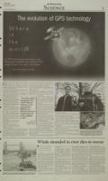
G lobal Positioning Satellites were originally
developed by the U.S. Department of Defense
for military use. Since then, scientists and
technology enthusiasts have expanded the use of these
advanced navigation systems, and helped the technol-
ogy break into the nainstream.
Two current everyday uses for the technology are in
a hide-and-seek game called geocaching, and to allow
students to track University buses.
GPS devices use a process called triangulation to
locate a point within centimeters of its actual position.
Satellites orbiting the earth continu-
ally transmit signals telling devices
exactly where they are located. "F o -h
"From the coded information that a "From tn
(GPS device) receives, it can compute informati
the difference in distance between it
and each one of the satellites it sees," a (GPS d
said Chris Ruf, a professor of elec-
trical engineering and atmospheric, receives,
oceanic and space sciences.
The GPS device must be able to compute
receive and transmit information
to at least three satellites in order differenc
to calculate its distance from them.
These distances are then used to distance k
draw a sphere around each respec- .
tive satellite, which represents the it and eae
center of a sphere. Next, the device
calculates the distance between of the sat
each satellite and itself, in order to .r
define the intersection point of all it sees.
three spheres.
The intersection point of the three
spheres will then give the device's
exact position. En
Because the process requires at A
least three lines of sight, several
satellites are required to operate the
computers effectively.
"There is a constellation of 24 GPS transmitter satel-
lites in orbit" Ruf said. "Because of the way their orbits
are interleaved, a GPS receiver on the ground can usu-
ally see three or more of them at any one time."
Before 2000, the Department of Defense attempted to limit
public use of GPS devices by decreasing their accuracy, mak-
ing the process of pinpointing a location more difficult.
E
e
C
Former President Bill Clinton chose to abolish this
policy in favor of an attempt to "encourage the accep-
tance and integration of GPS into peaceful civil, com-
mercial and scientific applications worldwide."
Little did Clinton know that his policy change would
lead to the development of a highly popular activity
called geocaching.
Within three ,days of this change, a cache had been
hidden in Portland, Ore. for GPS users to locate, and
was visited by two different GPS users the same day.
Thus the chase now pursued by several University stu-
dents was born.
Participating individuals, setup
coded caches - which are small storage
boxes - all over the world and list the
n that location of these boxes on the Internet
at www.geocaching.com. Currently,
Dvice) 227,249 caches have been placed in
220 countries.
t can Anyone with access to a GPS sys-
tem con then use 'the Internet coor-
-he dinates to search for these caches.
Once found, a cache may provide the
in visitor with a wide variety of rewards.
According to the online website, com-
)etween panies will sometimes sponsor hard-
to-find caches and load them with
one large monetary rewards.
Business School senior Mark Loe-
DI1ites sel, who participates in the activity,
said that the typical cache will con-
tain items that cost less than a dollar
like, "golf balls, key chains, baseball
- Chris Ruf cards, and bouncy balls."
Loesel said that caches usually con-
ineering tain, "a pad of paper to log the date,
SS professor what you took, and what you left."
GPS devices that can be used for
geocaching cost about $90. Students
like Loesel usually go in groups of two
to three looking for caches around Ann Arbor.
GPS is also being integrated into the University bus
system. Ruf is leading a project,. called Magic Bus,
which will integrate the navigation system with the
campus bus system.
Ruf said this project has two objectives. "One is to
help transportation services monitor and optimize their
g
0
bus routes and schedules."
"Another is to provide riders with helpful real-time
information about where the buses are and when they
will arrive at particular stops," he added.
The system will be accessible to students in a variety
of ways: a live web feed, text messaging updates, and an
automated AOL Instant Messenger buddy.
Currently, "about 50 students are evaluating the per-
formance of the 'beta version' of the public web site,"
Ruf said. It "will be displayed on the screens in the
hallways at Pierpont and, eventually, at other bus route
hubs," he added.
Additionally, Ruf said his group is developing, "an
interactive public web site that a user will be able to
customize in a number of ways."
Since last fall, more than 42 students have participat-
ed in the project and about a dozen buses have already
been outfitted with the units.
The group plans on installing about a dozen units
each month and expects to have the entire fleet outfitted
by April.
TOP: (JUSTIN BASS/Daily) BOTTOM:(MIKE HULSEBUS/Daily)
TOP: Business School senior, Mark Loesel (left),
and Engineering Graduate Student Jonathan Mott
(right), are involved in geocaching, a modern day
treasurerhunt. BOTTOM: An open cache in a park
in western Michigan, located with a GPS device.
N
Whale stranded in river dies in rescue
EL ost animal dies
from dehydration
and lack of food
LONDON (AP) - The lost and
distressed whale stranded in the River
Thames died last Saturday as rescue
workers ferried it on a rusting salvage
barge in an effort to release it in the
open sea, an animal rights group said.
The 20-foot-long Northern bottle-
nose whale had been lifted onto a
safety," said RSPCA scientific officer
Leila Sadler.
Swaddled in blankets on the barge,
the marine mammal - watched by
thousands in London as it spent two
days swimming up the murky river
past some of the capital's most famous
landmarks - had shown signs of
increasing stress and stiffening mus-
cles, an indicator it was in serious dif-
ficulty.
"The animal suffered a series of
convulsions at around 7 p.m. (2 p.m.
EST) and died." Sadler said. "It was
ered to a sling and lifted by a crane
onto the barge Crossness. Rescue crews
were heading toward Margate, on the
southern English coast, where they
hoped to let the whale back out to sea.
"There was a real chance that the
rescue attempt could have succeeded,
but these type of mammals are very
prone to the effects of stress and I'm
afraid it all became too much," said
Tony Woodley, spokesman for the
British Divers Marine Life Rescue
group, which led the rescue attempt.
"It was always going to be a race
really is a terrible shame."
Experts had warned earlier that the
Northern bottlenose whale, normally
found in the cold North Atlantic, may
not survive. Witnesses said the mam-
mal's snout was bloodied, and photos
appeared to show damage to one of
its eyes and a number of cuts on its
torso.
Earlier, veterinarians and rescu-
ers waded into the river near Albert
Bridge to assist the whale, taking
medical, tests and attaching an inflat-
able nontoon to the animal as London-
Scanned image of the page. Keyboard directions: use + to zoom in, - to zoom out, arrow keys to pan inside the viewer.
January 24, 2006 (vol. 116, iss. 60) - Image 5
- Resource type:
- Text
- Publication:
- The Michigan Daily, 2006-01-24
Disclaimer: Computer generated plain text may have errors. Read more about this.